Geoscience Knowledge Sharing
Type of resources
Keywords
Publication year
Topics
-
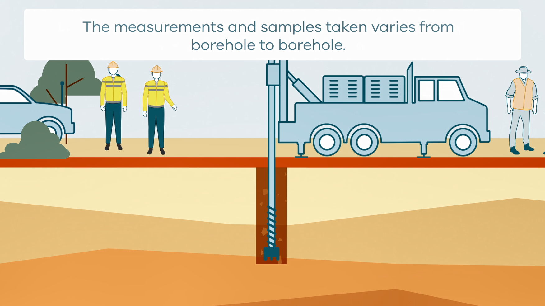
This animation shows how stratigraphic drilling is conducted. It is part of a series of Field Activity Technique Engagement Animations. The target audience are the communities that are impacted by GA's data acquisition activities. There is no sound or voice over. The 2D animation includes a simplified view of what stratigraphic drilling looks like, what measurements and samples are taken, and how scientists use the data.
-
This animation shows how Airborne Electromagnetic Surveys Work, when conducted by a rotary wing (helicopter) aircraft. It is part of a series of Field Activity Technique Engagement Animations. The target audience are the communities that are impacted by our data acquisition activities. There is no sound or voice over. The 2D animation includes a simplified view of what AEM equipment looks like, what the equipment measures and how the survey works.
-
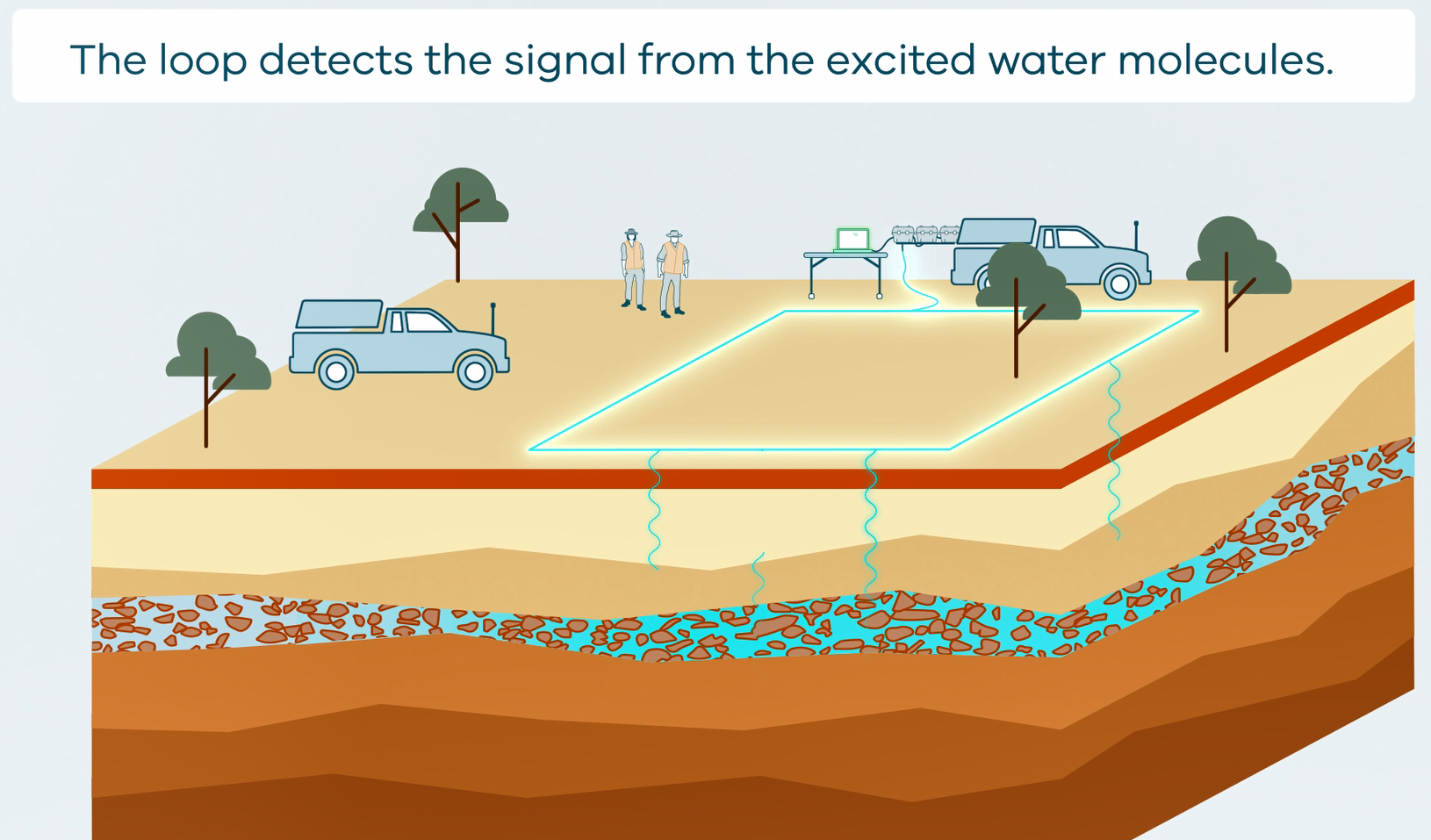
This animation shows how Surface Magnetic Resonance (SMR) Surveys are conducted. It is part of a series of Field Activity Technique Engagement Animations. The target audience are the communities that are impacted by GA's data acquisition activities. There is no sound or voice over. The 2D animation includes a simplified view of what SMR equipment looks like, what the equipment measures and how scientists use the data.
-
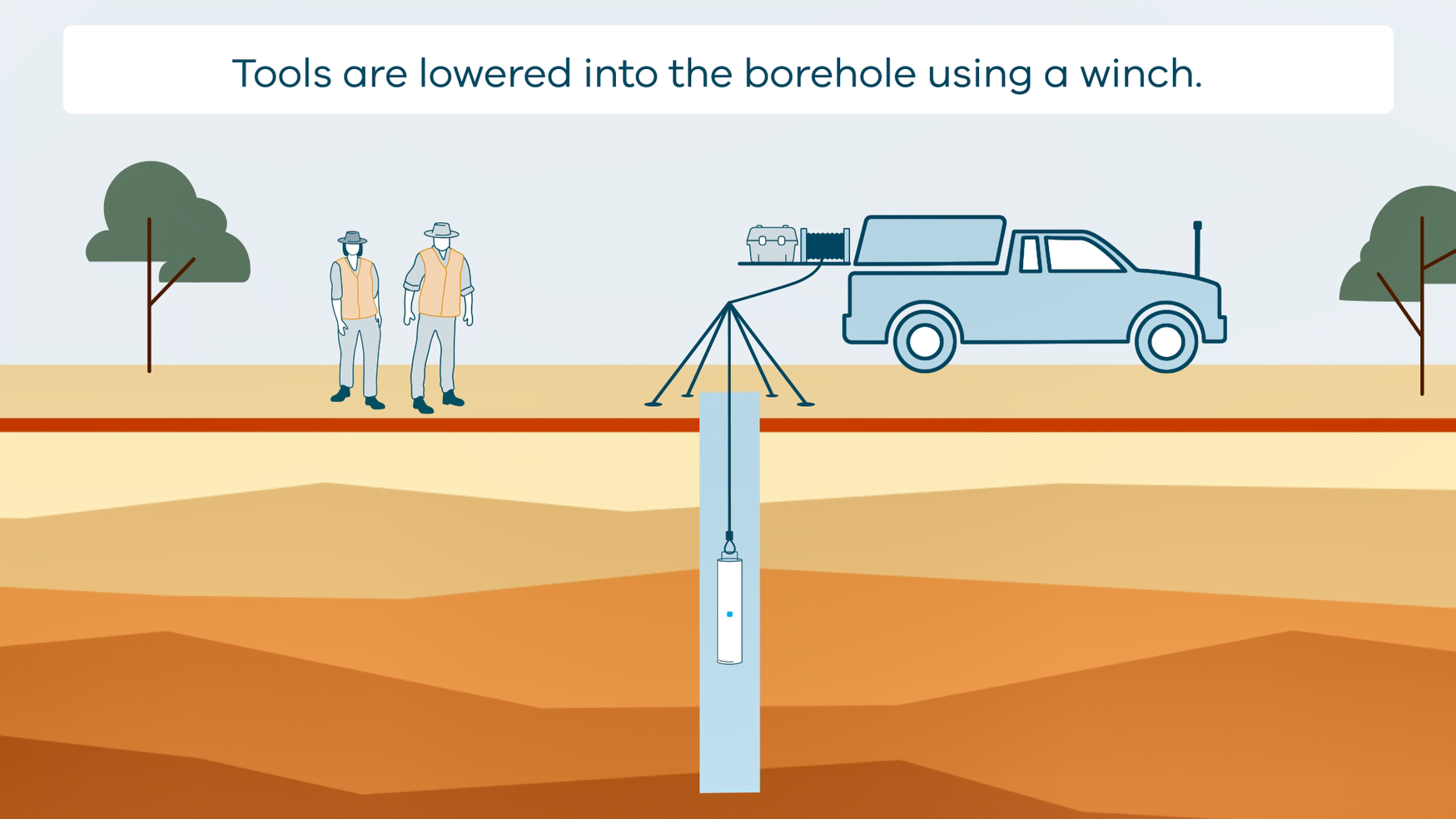
This animation shows how borehole geophysical surveys are conducted. It is part of a series of Field Activity Technique Engagement Animations. The target audience are the communities that are impacted by GA's data acquisition activities. There is no sound or voice over. The 2D animation includes a simplified view of what borehole geophysics equipment looks like, what the equipment measures and how scientists use the data.
-
Explore important concepts about groundwater using this comprehensive teaching resource. This mini unit includes case studies of Australian groundwater topics, First Nations Australian perspectives about water use and groundwater are also included. This mini unit included four files - the guide, 2 x student activities and a kml file. The guide includes educator tips as well as answers to the student activities. Suitable for upper primary to lower secondary students.
-
This animation shows how Airborne Electromagnetic Surveys Work. It is part of a series of Field Activity Technique Engagement Animations. The target audience are the communities that are impacted by our data acquisition activities. There is no sound or voice over. The 2D animations include a simplified view of what AEM equipment looks like, what the equipment measures and how the survey works.
-
This animation shows how passive seismic surveys Work. It is part of a series of Field Activity Technique Engagement Animations. The target audience are the communities that are impacted by our data acquisition activities. There is no sound or voice over. The 2D animation includes a simplified view of what passive seismic equipment looks like, what the equipment measures and how the survey works.
-
This animation shows how Magnetotelluric (MT) Surveys Work. It is part of a series of Field Activity Technique Engagement Animations. The target audience are the communities that are impacted by our data acquisition activities. There is no sound or voice over. The 2D animation includes a simplified view of what magnetotelluric (MT) stations and equipment looks like what the equipment measures and how the survey works.
-
This animation shows how Reflection Seismic Surveys Work. It is part of a series of Field Activity Technique Engagement Animations. The target audience are the communities that are impacted by our data acquisition activities. There is no sound or voice over. The 2D animation includes a simplified view of what reflection seismic survey equipment looks like, what the equipment measures and how the survey works.
-
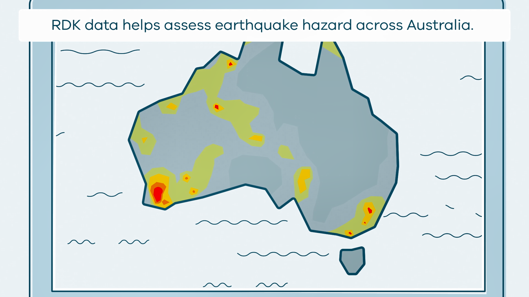
This animation shows what happens when rapid deployment kits (RDKs) are deployed after an earthquake. It is part of a series of Field Activity Technique Engagement Animations. The target audience are the communities that are impacted by GA's data acquisition activities. There is no sound or voice over. The 2D animation includes a simplified view of what rapid deployment kits (RDKs) look like, what is measured, and how scientists use the data.